Find the right map art to celebrate Africa’s geography, history, and beauty. This guide highlights five top options that balance artistry and clarity, helping you choose pieces that suit classrooms, living rooms, or offices. Best for educators, travelers, and decor enthusiasts who want clear, attractive maps that double as conversation starters. The selections emphasize readability, durable print quality, and versatile styles that fit modern interiors.
Summary of top picks
| Product | Brand | Format | |
|---|---|---|---|
| ShopHaven Africa Map Wall Art | ShopHaven | 11×14, Unframed print | Bedroom, dorm, home office decor |
| NBEADS Africa Map Metal Wall Decor | NBEADS | 11.8×9.7 inches, metal silhouette | Living room, entryway, garden walls |
| Africa Wall Map GeoPolitical Edition | Swiftmaps | 18×22, Laminated | Educational spaces, offices, classrooms |
| National Geographic Africa Executive Wall Map | National Geographic | 24×31 inches, art quality print | Large walls, professional settings |
| Negroland Map – Adjacent Countries | ArtCantHurtU | 16×20 inches, unframed | Historical study, academic displays |
ShopHaven Africa Map Wall Art
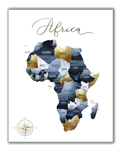
This 11×14 unframed print prioritizes color fidelity and clarity. With a luster matte finish and UV coating, it preserves brightness while resisting fading, making it ideal for bright rooms or spaces with indirect sunlight. Best for bedrooms, dorm rooms, or home offices where a compact, elegant map is preferred. The print is ready to frame, giving buyers flexibility in framing style and wall size.
Best for: small to medium walls, personal spaces, gift-giving. Limitations: unframed design means you’ll need to choose a frame that matches your decor, which may add to the total cost and time to install.
NBEADS Africa Map Metal Wall Decor

This metal wall silhouette features Africa’s map adorned with animal silhouettes and forest landscapes. It’s designed to be hung with two nails and is finished in electrophoresis black, offering durability and a striking contrast on light-colored walls. Best for entryways, living rooms, or offices where a bold, sculptural piece adds dimension. Caution: metal art can be heavy; ensure wall studs or anchors are suitable for secure mounting.
Best for: statement walls, contemporary interiors, outdoor-adjacent spaces where weather is not a factor indoors. Limitation: size and weight may require careful mounting planning in small rooms.
Africa Wall Map GeoPolitical Edition

This laminated 18×22 map blends political data with a 3D physical relief layer, providing a dual perspective. The laminated stock ensures durability for frequent handling in classrooms or study areas. Best for teachers, students, or business environments that require a clear reference map with a touch of dimensional depth. Choose this if you want a balance between educational detail and decorative appeal. Caution: larger format requires substantial wall space and a sturdy mounting solution.
National Geographic Africa Executive Wall Map

National Geographic presents a large 24×31 inch map with refined colors and up-to-date geography. Printed on polypropylene for crisp color and legibility, it’s well-suited for offices, classrooms, and living areas with ample wall space. Best for: users who want a durable, professional map with strong brand reliability and a modern finish. Limitation: the larger size may not suit compact rooms and may require planning for placement and framing if desired.
Trademark Fine Art Africa Text Map

Michael Tompsett’s canvas artwork presents Africa through text and contemporary styling on a 16×24-inch gallery-wrapped canvas. Made in the USA, this piece blends map elements with a typographic approach for a modern, artistic feel. Best for: modern living rooms, home offices, or galleries seeking a stylish, conversation-starting map. Limitation: text-based design may emphasize aesthetics over geographic detail for precise location lookup.
Buying Guide
What to consider when choosing Africa map art:
- Style and finish: Do you want a photographic map, a minimalist silhouette, a colorful political map, or a canvas with graphic typography?
- Size and wall space: Measure available space to avoid overpowering a room or leaving the wall feeling sparse.
- Material and durability: Canvas and laminated prints resist wear; metal silhouettes offer bold, three-dimensional presence; unframed prints provide framing flexibility.
- Intended room: Bedrooms and dorms benefit from softer finishes, while offices may favor sharper colors and larger formats for visibility.
- Mounting considerations: Large maps may require studs or anchors; metal art often uses simple hooks.
- Educational vs. decorative goals: For classrooms or study spaces, prioritize maps with legible lettering and up-to-date geography; for decor, choose color tones that match your palette.
Frequently Asked Questions
- Which Africa map art is best for classrooms?
– Maps with clear, legible labeling and up-to-date political boundaries, such as the Swiftmaps laminated edition, provide reliable educational reference. - What size is good for a small wall?
– An 11×14 or 16×20 inch map, like the ShopHaven print or the Negroland map, fits nicely in compact spaces without overwhelming them. - Should I choose a framed or unframed piece?
– Unframed prints offer framing flexibility to match existing decor; framed options create a polished, ready-to-hang look. - Are metal map art pieces durable for busy areas?
– Yes, metal silhouettes like the NBEADS option are sturdy and make a bold statement, but ensure proper mounting for safety. - Which map art blends modern aesthetics with geography?
– Canvas and typography designs, such as the Trademark Fine Art option, combine contemporary visuals with geographic context. - Do these maps reflect current country boundaries?
– Most products aim to reflect up-to-date naming and borders; confirm labeling accuracy if precise geopolitical data is critical for your use.